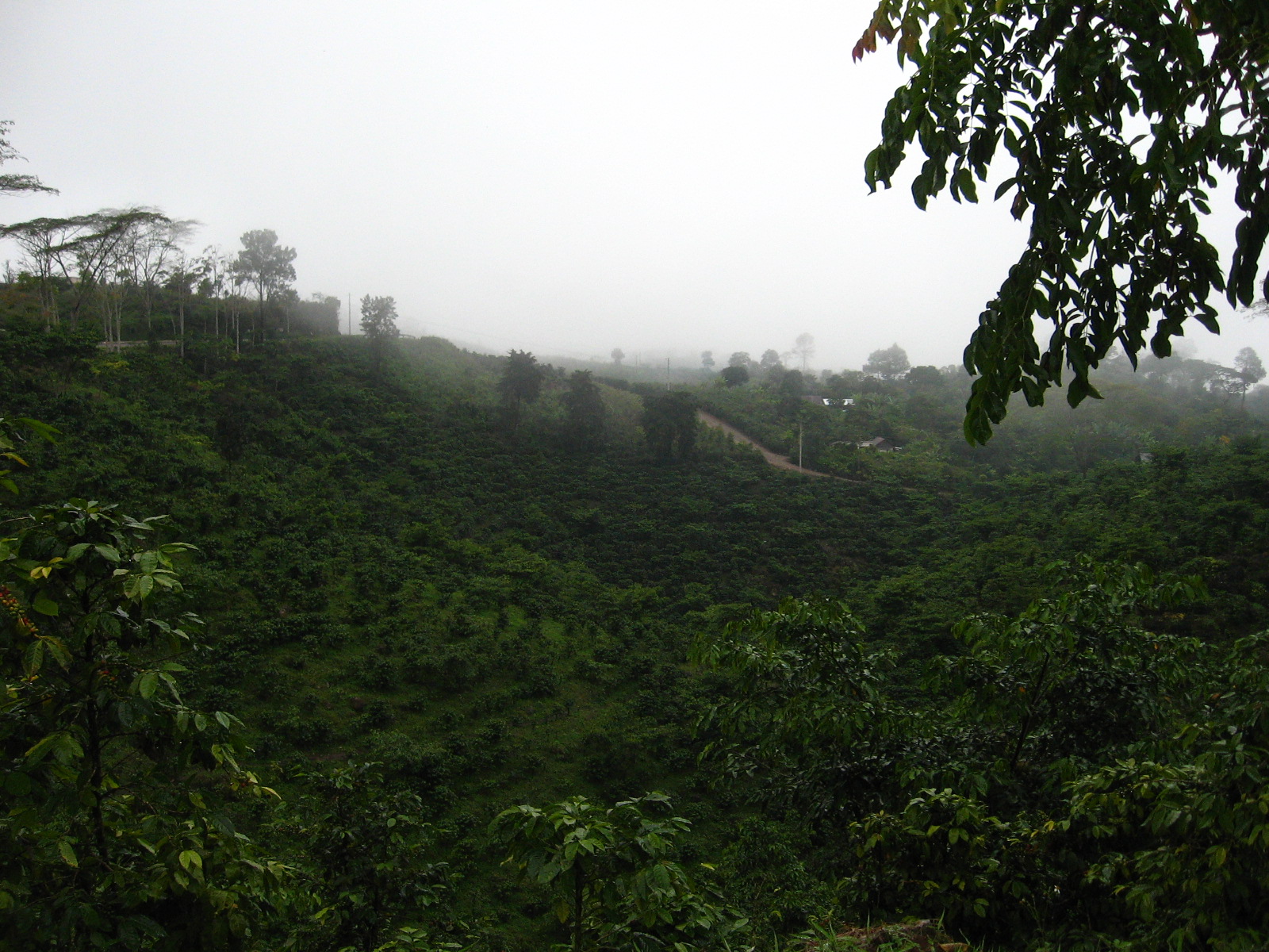
The department of Alta Verapaz is famous for its coffee and as i was getting closer to its capital, more and more hills were covered with plantations.
I stayed at the la paz hotel, a nice guesthouse in a tranquil part of town not far from the city center. Just next door was a cafeteria which served the best coffee i tasted on this trip so far. A good cup of coffee is sadly not too common in many parts of Guatemala since most of the coffee is produced for export.
I was planing on staying in town for a while and look for a spanish school. The first that i had researched was closed, i didn’t have the address and never received a reply from the second one and the third one was not to my liking. Coban was in one aspect everything i wished for in a place to learn spanish: off the tourist trail. But after two days of searching without any result, i already felt like moving on and after a couple of emails to schools and positive replies, i set off towards Quetzaltenango.
I had heard about the bad road conditions after a big landslide swept away a part of the road in 2008. And as there was no official attempt to repair the damage, there is now a make-shift road built by the people of the surrounding villages.
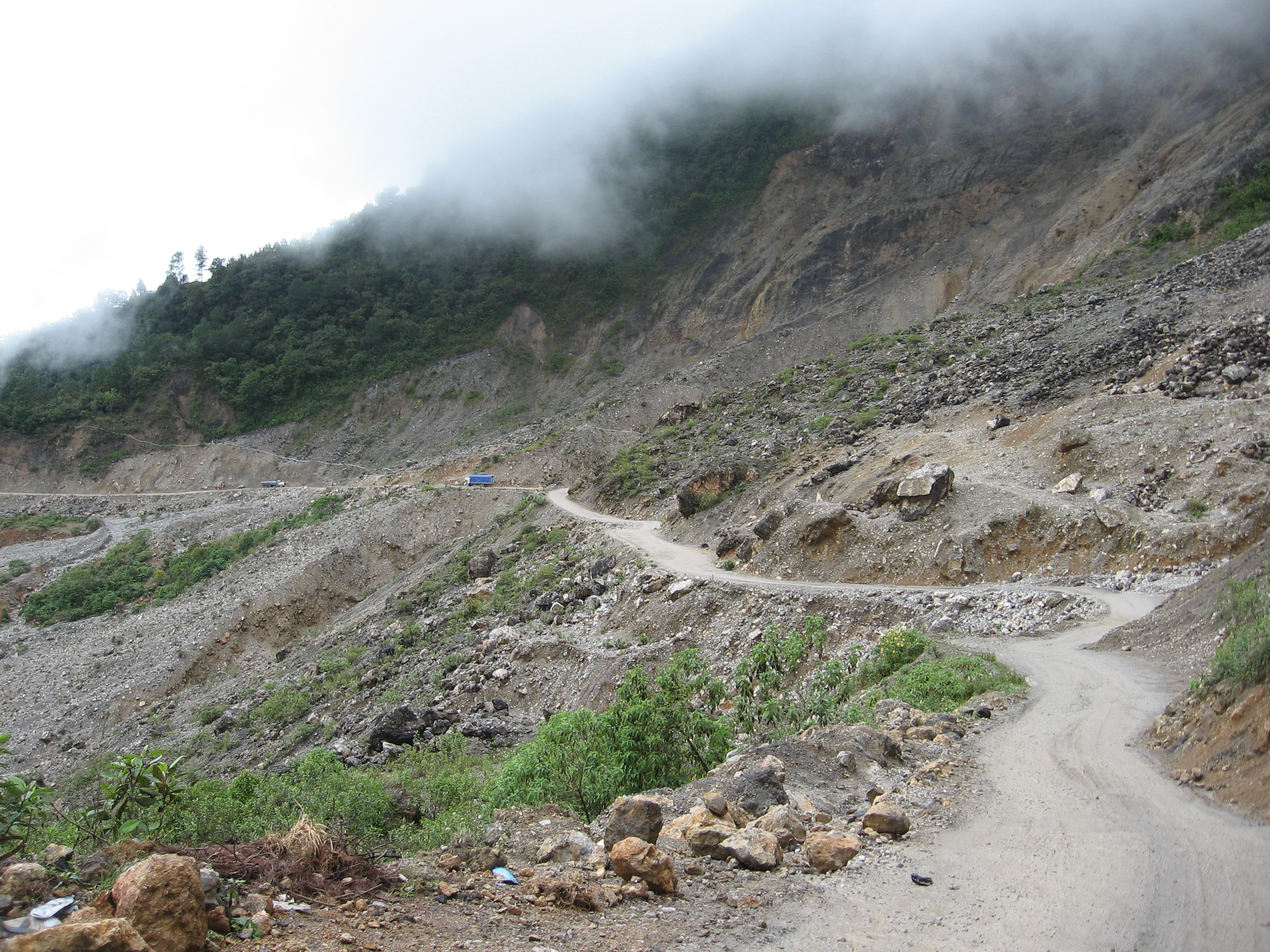
There were worse parts along the way than the few hundred meters of that road past the landslide and it was at a slow pace that i continued towards Sacapulas, where i intended to stay only for lunch but ended up staying the night in a nice guesthouse with a great view from the balkony over the river.
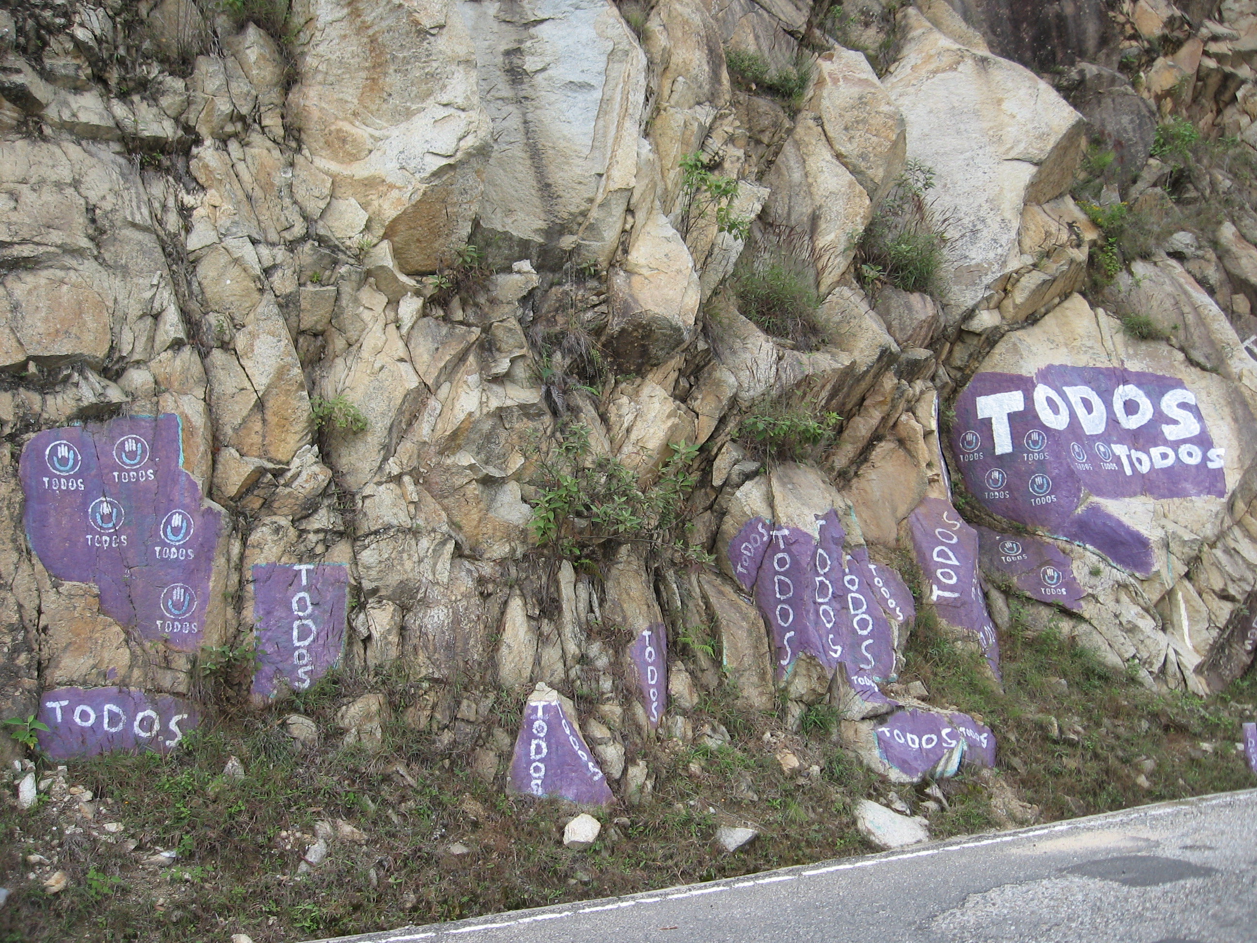
I set off early in the morning. Knowing that my goal for the day lies 2500m above the sea level whereas my starting point only at 1200m. And by now familiar with the roads of Guatemala, i wasn’t expecting one gentle climb. But at the beginning of the day i had such a nice time cycling until Santa Cruz del Quiche, with finally some stretches without road damage, heavy traffic or steep climbs, just the omnipresent political slogans. The parties must have armies of people running around the country and painting the sides of the roads with their colours slogans.
From Santa Cruz del Quiche it was another five hundred meters to climb to Toto, but first the road dropped steeply towards a river, into a beautiful valley with sheer rock walls on both sides and just enough room for a narrow road next to the riverbed. Once i climbed out of the valley, the road followed a mountain ridge with beautiful views over the surrounding valleys and still i was not worried although the sun was sinking low. It was not until a certain kilometer marker, around which i had expected to reach the city, that i grew suspicious. According to my map i should have reached the town by now. In the end, the map was ten kilometers off. Ten kilometers of a gnawing uphill part through a ever darkening forest. At that time, i was really glad i had brought a headlamp in addition to my front light as there was no other light whatsoever, if not a blinding one from an oncoming truck. An hour later, i reached the end of the forest and after another bend i saw the lights of Totonicapan spread out before me. I was still around three hundred meters above the city and after the downhill through the night chill, my hands were stiff as a rock. I got directions to a nice guesthouse near the central plaza and a chinese comedor which served a plate big enough for two and even i had to take a little break before finishing it. But it didn’t take long until the thought of a dessert crossed my mind.